Wind speedmph |
TemperatureF |
Wind Direction |
Relative Humidity% |
Burn Timehour(s) |
|
WX:
manually updated.
Time:
Wind speed:
PIG:
---
1HR:
---
10HR:
---
100HR:
10H + 3%
Herb:
---
Woody:
---
LFM:
Weather Forecast:
Fuel:
Perimeter Resolution:
meters
Ensemble:
Ensemble: none.
Generate ROS & Flame Length:
Name:
Name Format: CA-(XXX)-(NAME)-OESM-YYYY-MM-D_HH:MM
Burn Time:
hour(s)
Start Time:
| Drag points to change weather conditions. |
|
|
|
|
|
|
|
|
| Imports from |
Showing last 10 ignitions |
|
Reverse
Legend
|
| Time | Name | Acres |
|---|
| Historical Fires |
| California: 1878-2024 |
| United States: 2006-2024 |
Year: 2005 - 2018 |
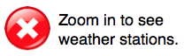
Weather Stations
Measurement:
Show Station Labels:
Edge Sensors
Measurement:
Air Quality Stations
Measurement:
Weather Forecast
Weather Forecast
Ensemble Size:
Variance: feet
Time
Display fire as
Display frequency
ETA time offset
Include area within ignition
Include adjacent burned areas
Fire: |
Select fire(s) to load.
| Id | Fire Name | Incident ID | Description | Start Time | User | Group |
|---|
Channel:
Group:
Select file to load.
| Name | Last Modified |
|---|
Choose camera:
Cameras
FOV:
Target:
| Edge: |
Fire: |
| Fire | |
| Start | |
| Stop | |
| Speed | |
| .... | |
NASA GIBS
GOES GeoColor
Last Update: Pending
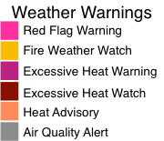
Official fire perimeters are usually updated once a day for active fires.
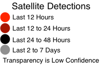
Satellite updates are approximately every 6 hours.
For more information about how to use this map, see our videos.
Firemap is created by WIFIRE. See the FAQ for details about the map.
Questions or comments? Contact us.
Download
Please enter filenames with no extensions.
| Perimeter: | |||
| Spread Rate: | |||
| Flame Length: | |||
Firemap accounts are for fire agencies and researchers. Please register for an account only if you are in one of these groups. If you are not affiliated with a fire agency, you may not be contacted.
For more information about how to use this map, see our videos.
Choose selection:
Choose selection:
Our disclaimer has changed. Please read the following before proceeding:
Screen Capture
File name: .png
Choose Import Source
|
Probability
|
|
|
|
|
|
Opacity
|
|
|
Model Information
No camera displayed